(From the Danish to the Polish Border)
May/June 2002
By Reinhard Zollitsch
PART I: FLENSBURG - LÜBECK
Boyhood memories
It took me about half a century to get back to my place of birth and realize one of my boyhood dreams: follow the coastline of the German Baltic from the border with Denmark to the mouth of the Oder River, the border with Poland. I vividly remember one of my early readers (August Clausen: Peter Jünk’s Travels with the Seagull, a spin-off of the Swedish writer Selma Lagerlöf’s book: Nils Holgersson) where a boy my age was dreaming of seeing the world around him.
So he visualized himself riding a mighty, very cooperative and well-informed seagull (or wild goose in Sweden) up and down the coastlines of Schleswig-Holstein, our home state. I decided then that I was going to go beyond those borders and see the entire coastline of the Baltic and who knows what other parts of the world and especially the oceans.
Well, I made it through puberty, graduate school and even four kids in college, when I suddenly remembered this dream. It all started when I was called to attend an important family gathering back “in the land of my birth”, the old “Heimat”. I had talked myself out of so many events before that this time the prodigal son in me was overcome with guilt and moral compunction - I had to attend.
The party also fell close to the time that I had left for the US forty years ago, and I thought to myself that that would be a nice occasion for me to celebrate my 40 happy and successful years in America. But what really made me buy the Lufthansa ticket was my wife’s suggestion to plan some canoeing around that event. Perfect, I thought, noticing something deeply stirring in my mind, something archetypal almost. And then it came out: THAT TRIP ON THE BALTIC.
Everything suddenly fell into place. I was going to follow the entire German Baltic coast, of course, now that Germany was united, all 440 miles of it (700 km). I would put in right on the Danish border in Flensburg and paddle the first 235 miles to the city of Lübeck to arrive just in time for the party there, reprovision my boat and continue to the Polish border near the Oder River in the last German-speaking town of Ahlbeck.
Logistics
Problem one: could I ask my sister to car shuttle me to those two places if I promise to come to her party? Why not. What is family for, right? She promised to do that, but I noticed her big smile, suggesting that she did not believe I would go through with it or could, because she knew it was impossible. “He doesn’t even have a boat here - but it’s nice he is coming to my party.”
So, I needed a boat, paddle and charts. After September 11, 2001, no airline would transport larger goods for private people. I learned I could not even fly with my 11 ounce, 50 inch long carbon fiber paddle. A dismaying setback of my plans, because the paddle is my motor; the boat is not really that important. But I needed a canoe, not just any boat; my wrists and my spine do not like kayaks. Then I had a brilliant idea: why not show Germans how we canoe in America, i.e. paddle an open Native American style canoe, like an OLD TOWN, which, what a happy coincidence, are made less than 5 miles from my home in Orono, Maine.
A couple of e-mails later I had a very enthused and supportive promise from the Old Town dealer in Hamburg, Germany, that I could “test” a Penobscot 16 on the Baltic in return for a report with pictures. Thanks, Uwe!
Now for the charts. I asked various family members and old sailing buddies of mine in Germany to case the joint, but the first reaction was always the same. “What do you need those for? You are only traveling in a canoe along the shore. Why do you need to know where all the wrecks are?” I always ignore first reactions and press right on and eventually got a website of a chart publisher. I contacted them, screened the charts, and they were just what I needed, like our American small craft charts. They were willing to ship them over to me so I could study them in advance and decide where I could plan my overnights, etc. They even suggested I pay in the new EURO currency after I arrived in Germany - how very accommodating.
Even though the charts were expensive, I would not suggest anybody paddle the Baltic without them. They were not only filled with the usual nautical information, like depth of water, accurate shoreline, markers, harbors, but also full of mention of restricted areas, some of them extending 5-10 miles. There were submarine practice areas, torpedo launching sites, mine-laying training areas, tank firing ranges ashore and target areas in the water, as well as lots of areas with unexploded ordinances, especially in the former communist East Germany.
But the most enigmatic restriction read: “Seuchensperrgebiet”, and it encircled an entire island. What was going on there? Had the plague broken out in Germany while I was away? How is one supposed to navigate around those areas in a 16’ open canoe? And then there were a myriad of bird sanctuaries, wildlife and nature preserves, biospheres and national parks, all the NO TRESPASSING type, and often extending far out into the sea. And last but by no means least, did you know that in Europe you leave the red buoys on your LEFT returning to port, not “Red, Right, Returning” as in US waters?
I was not sure whether I was going to share all this information with my dear wife, but she sensed that something was rotten south of Denmark. But it was not going to deter me from attempting my adventure and finishing it successfully and on time. My quiet little boyhood trip had turned into a feat, a challenge, and lots of people in Germany could not wait to see me falter, already mouthing their answer: I told you so. It can’t be done.
10 days before my departure, I still did not have a paddle. Do manufacturers have the same restrictions as private citizens? I wondered, and already dialed the number. No problem, was Zaveral’s answer, and one of those high-tech wonders, my “Wunderwaffe” for the Baltic, was in the mail that same afternoon, regular airmail for only $ 22 postage, and it got there fine with a few days to spare. Thanks, Zaveral!
My two army duffels were packed with tent, sleeping bag and pad, you name it, down to my granola mix for 21 days, peanut butter, sun-screen and satellite phone. All I needed was some German Dinty Moore stew or spaghetti goo, bread and water, carrots and apples, so I could say I satisfied the need for all four food groups. I would have to borrow a small one-burner propane stove, since you cannot fly with propane, and tank fittings never match.
It was a relief to see all my gear at the Hamburg airport, be met by family, drive to the boat dealer, find him home and willing to part with a brand-new “umweltfreundlich” green Royalex OLD TOWN Penobscot 16 and get to Lübeck. That same afternoon my brother-in-law and I installed the hip braces (which I had precut at home) on the side of the bow seat, because I was going to canoe the boat from that seat in the “wrong” direction, i.e. stern first, so I would sit more towards the middle of the boat for better control.
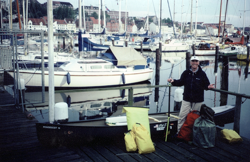
Start at the Danish border
We tied in a 3-foot plexiglas deck over the bow, then duct-taped it. And finally we tied in the retainer ropes to which I would clip my waterproof packs and water containers with carabiners, so they would not float away, should the unspeakable happen.
I was ready, everything was in place but the weather radio. My American marine radio -telephone did not pick up any weather station, nothing, as a matter of fact. (I later learned there was none!) So I was reduced to basics in the weather department: observation and a pocket-size camping thermometer (big woop). I felt quite exposed, but told myself that the Vikings and the traders of the Hanseatic League did not have it any easier either.
The trip begins
Getting up at 4:15 a.m. on May 24 did not seem too bad light-wise, because the Danish border is about 55 degrees north, and summer solstice is less than a month away. By 8:00 a.m. we were in Flensburg, all gear was stowed in the boat and clipped in, the new compass was mounted right in front of me on the middle thwart. I was ready, and I could not wait to push off and be paddling. “See you 11 days from now, high noon, in downtown Lübeck near the old Holsten gate. And thanks for everything.” I was off - what a relief.
The boat felt a bit sluggish with all the gear, but that was to be expected. I would not stop to re-supply till Lübeck, just top off my water once in some harbor. But I was still making 3 knots and was happy to be paddling. I even had my favorite light-weight Zaveral paddle.
Following an international border is always exciting: Germany on my right, Denmark on my left, around Holnis Point all the way to Habernis at the western edge of Gelting Bay. I found a perfect spot on the beach in front of the typical glacial break-off shore (“Abbruchküste”) consisting of sand, gravel and loam with big rocks (glacial erratics) strewn all along the shore. I had picked a perfect spot from the chart, between towns and major beaches, fairly inaccessible from shore and right at my predetermined 20 nautical mile marker (22.5 statute miles, my daily goal). Setting up camp for the first time on a trip is always a test. Had I thought of everything? It was all there, and even my satellite phone worked for a quick call home to Orono, Maine. (By the way, on my phone bill, my satellite phone had me located in Denmark - ‘very interesting’.)
With early sunrises, I decided to be on the water by 6:00 a.m., which meant getting up at 4:50. I enjoyed my instant coffee - well, it was nothing compared to my fresh-ground coffee at home - but my tasty granola mix suffered noticeably after I poured fat-free powdered milk with water on it. Better get used to it fast and like it, I told myself, because this is going to be it for the next three weeks. My first German “Dinty Moore Stew” equivalent was quite palatable, a bit on the chewy side but perfectly eatable. The label on the can identified it as “Geflügelsuppe”, which I facetiously translated into “fowl soup/foul soup”.
Gelting Bay was big and it was getting windy right out of the SW. I enjoyed the ride to Birk Point with the waves breaking from behind, but on the other side of the point the wind veered to the S and SE following the shoreline, and that meant right on the nose. I had to dig deep to make any progress in my not-so-sleek open two-man canoe. I slugged along till I came to the lighthouse at Schleimünde, marking the entrance to the Schlei fjord, which almost bisects the Jutland peninsula.
It was therefore used by the Vikings as a major thoroughfare from the Baltic to the North Sea. At the end of the Schlei at Haithabu, a major trading city with protective walls all around, the Vikings would unload their goods on oxcarts and transport them for about 10 miles to the Treene River, which in turn flows into the Eider River, which empties into the North Sea. A very historic place, and in my mind’s eye the sailing boats entering and coming out of the narrow entrance all turned into clinker-built Viking ships with square sails and dragon heads on the bow.
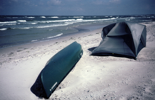
After 5 more miles going straight south, I pulled out on a rocky beach and made myself as inconspicuous as possible. I put up my granite gray tent beside some big beach erratics and pulled up my green boat to the edge of the beach grass and rosebushes. I was getting close to one of the biggest resort areas around, Damp 2000 (pronounced “dump 2000”), which was everything but a dump.
I was more than a mile north of it, but I had underestimated German wanderlust, and all afternoon, properly attired and shod Germans with expensive binoculars slung around their neck would stride by my place, on the other side of my big rosebush, to be exact, and not see me. I enjoyed being unnoticed, and had a great time reading, writing and just looking around; listening to the many different birdcalls, including the cuckoo, and taking in the new smells, which I only remembered faintly from my youth.
From Viking to NATO stronghold
Tomorrow was going to be a challenging day according to my charts. I had to negotiate a number of military “Sperrgebiete”, restricted areas. The mine-laying practice area was no problem, nor was the ammunition dump - I could go inside of them, but I would have to watch out not to collide with a sub in the sub training area or be tagged by a torpedo at the firing range. I had to go through those areas; there was no way around for me. But I figured since it was Saturday and no self-respecting German Nato soldier would shoot on a weekend, and definitely not before his second cup of coffee, I was relatively safe, at least till 9:00 a.m.
My worries remained unsubstantiated and the Bay of Eckernförde was instead filled with clouds of sailboats enjoying a stiff southerly breeze. I on the other hand had to work hard to make it around this large bay, and after eight hours in my boat, I decided it was time to get ashore, even though I was a mile or so short of my daily target. I’ll make it up tomorrow, because I was spent for today.
The shoreline into the next bay, the Kieler Förde, was steep and beautiful and stirred a lot of old memories in me. I was born in Kiel in 1939 and grew up there during the war and later went to college there. A mixed bag of emotions overcame me when I entered this bay. Vivid childhood images of my basement/air shelter years with neighboring houses aflame popped up but were quickly replaced with happy, hopeful student days filled with weekend sailing and rowing.

Typical Baltic shoreline
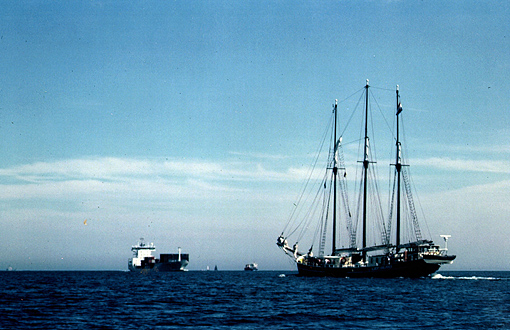
Big freighters were heading for the entrance of the Kiel Canal (connecting the Baltic with the North Sea) while others were steaming out of the huge locks into the open Baltic. Seeing those ships made me think of my grandfather, the old sea captain. He had sailed around the Horn many times, but towards the end of the war was pressed back into duty to pilot ships through the minefields in the outer bay. He admitted that not until then did he learn accurate navigation.
Approach to the Kiel Canal
I also passed the Olympic sailing center from the 1972 games on my right, at Strande, and remembered my happiest sailing memories on a 60-foot yawl, which was built specifically to sail in the trans-atlantic race from Bermuda to Germany as an opener for the 1936 Olympic games in Germany. After the war, the “Peter von Danzig” was donated to the University of Kiel sailing club (ASV) and was home to twelve students on many long- distance trips. We would sail for five weeks each summer, one year to Scotland, the Shetland Islands, Norway, Sweden, Denmark, and would try to come to grips with the ugly memories of the world of our fathers and try to turn them into happier hopeful ones for a better future for us.
I paused at the lighthouse of Friedrichsort to reflect some more while watching the seemingly endless parade of ships passing through the narrows. I crunched down my carrot, apple and PB&J sandwich, drank my four-day-old water and then decided it was time to move on. But I could not clear my mind of old memories completely till I had passed the huge war memorial right at the water’s edge on the Laboe shore. It looks like a tall submarine conning tower rising straight out of the sea. In the end, any war is always people who died for a cause, good ones and bad ones, names, like on the Vietnam memorial in Washington, just names; names of people who are missed by families and loved ones.
Just meters beyond the memorial, the frivolous beach life started, stretching for about 40 miles from here to the island of Fehmarn. I knew it would be difficult for me to pull out and camp on the beach, because each little town would claim its stretch along the Baltic and charge a user fee. But I had to stay in the little resort town of “Kalifornien”, coming from the US.
It looked hopeless at first: T-shaped breakwaters as far as the eye could see were protecting a flawless, groomed beach rimmed with fenced-off gleaming white dunes. German beach baskets were clustered every few hundred yards, and near them I saw bunches of fast looking catamarans and sailboards.
But my eight hours were up, the maximum time I set for each day; I had gone 25 miles, I simply had to beach my boat, and so I did. I decided to “hide” as a big granite boulder at the very end of a breakwater halfway between those beach basket clumps, in full view of everybody. Fortunately this was the off-season, the water was still quite cold and only few bathers or sun worshippers were out.
When I was all set up, I was proud of myself: I really looked like part of the breakwater. And would you believe it, later that afternoon, beach hikers came up to my tent and admitted that my “big rock”, my erratic or “Findling”, was their hiking target, and we had a good laugh together. I told them that this was my disguise hiding from the “Strandpolizei” - they liked that, and did not tell.
Tomorrow was going to be testy. I had to pass through another military restricted zone at Todendorf. It was much too large an area to go around, but I was a bit uneasy because it included a good 2 miles of shoreline as well. I would be in the area for at least 40 minutes. Would they see me and stop me? What then?
I got an early start, made it past the first signal tower, nice and steady and very visible from shore, so that nobody could think I was sneaking up on their military installation. (It was less than nine months after Sept. 11, 2001 and everybody was extremely alert and jumpy.)
I was just approaching the final tower when two guys in an outboard came chasing after me and hailed me with a bullhorn. “You just went through a military restricted zone. That is illegal, verboten @#&%.” “Am I through?” was my counter question, which they dumbfoundedly acknowledged and let me go on my way. I had some other great questions like: “Are we winning the war this time?” or “How many boats have we sunk already? Were those ours or theirs?” - but I bit my tongue.
At 9:00 a.m. sharp the shooting commenced, heavy caliber ordinances, out on the bay and along the shore I was going to pass tomorrow. They were at it all day, and spotter planes were dipping low over the water. When my time was up, I found a perfectly secluded place along the beach for the night, but decided to start even earlier tomorrow to get past that other firing range in the little town of Putlos before 9:00 a.m.
I had again made it to the last signal tower, when suddenly a big commotion started on shore. Cars and trucks were shifting, and people were running down to the shore and hailed me: “He, Sie da, kommen Sie doch mal her!” They obviously wanted me to come ashore. What about my second-cup-of-coffee theory? Having nothing to hide, I headed toward shore. When I was close enough for their high-powered binoculars to identify my University of Maine cap, I pointed to the side of my canoe where I had put on some stickers which read: “German Baltic, Denmark to Poland”, with a German and an American flag.
Then I pointed straight forward, making it clear I was continuing my course and not coming back or turning around. He must have been an officer: he got the message, sized me up in my little 16-footer, decided I was no threat to his outfit and waved me through. Minutes later the booming started, and again lasted till evening. I learned later this was a tank firing range on shore but it also had a target area in the water. Yesterday’s restricted zone, I learned, has young recruits shoot all types of guns, including machine guns, out into the open ocean, standing or lying on the high banks - not a pretty picture for a peaceful canoeist passing by.
Rounding Fehmarn Island
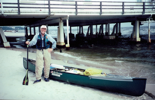
But this encounter was quickly forgotten when the beautiful arch of the most photographed bridge in Germany came into view, the car and train bridge across the Fehmarn Narrows to the island of Fehmarn. I had never seen this bridge since it was built in 1963, a year after I had left Germany for the US. I took lots of pictures, went through the middle span and back on the island side to my campsite on the Bay of Orth, a perfect jumping-off point for my 2-day circumnavigation of the island.
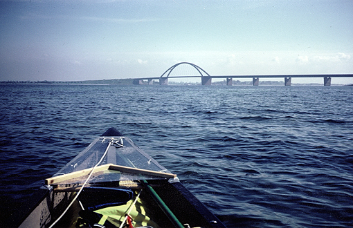
Bridge to Fehmarn Island
The afternoon turned very windy, and the entire bay turned white and filled with breakers. The wind did not let up much during the night and early morning, but I was going to try it anyway. I really missed my American NOAA weather reports that morning. Was it getting worse or better, I wanted to know. Was the wind going to shift south, which would be nice, or north, which would make the trip nearly impossible?
When I carried my last bag to the water’s edge and turned around, my tent was suddenly gone, totally out of sight. It had ripped out of the ground, stakes and all, and had blown up and over the dike, then tumbled for more than a hundred yards across an open field till it got caught in a hedgerow of trees. It looked like a large piece of tumbleweed, and I had to laugh. Fortunately the tent survived the excursion without damage, not so my ego, and yes, I would have to whittle new wooden tent pegs.
It was one of the wettest slugfests ever, across to the sandspit two miles away. The white of the ocean became ever whiter around the point. It was very shallow according to my chart, and the waves were breaking for about two miles out. There was no way around it and no way through it at that point. I had to sit it out or cancel my circumnavigation altogether and go back to the bridge and the “continent” or “Europe”, as residents would say. I wanted to take out at the point, but was unmistakably reminded that this was a nature preserve and there was no trespassing on Krummsteert (“Crooked Tail”).
It took me almost an hour to get beyond the borders of the preserve. I pulled out along the dike to warm up, dry out, pick up my spirits and rethink my predicament.
Two hours later the wind had settled somewhat and I felt warm, dry and fed and was poking my bow back around the same sandspit. I wanted to go around this island real bad, and suddenly noticed a channel between the outer break and the shore break, which was doable. I could dance through there in this boat, which proved to be surprisingly seaworthy, forgiving and dry, even running in beam waves. I knew that once I decided to round the point, I was committed for nine miles with a strong onshore wind, which would make for a very difficult, hard, and mostly wet and awkward landing.
It worked out fine. I was keenly watching every wave to see where it would break, then sprint or slow down to avoid that part. Adrenaline was kicking in. It was as exciting as a whitewater race, and after 100 successful yards, I even enjoyed the thrill of dancing with breaking waves.
After 3 hours I rounded the northwest point of the island, and the winds slacked off and came more or less from behind. Whew! My predetermined overnight stop was just past the National Park surrounding the memorial for the sailors lost in the Niobe disaster. This German sail training ship with 69 seamen aboard was hit in 1932 by a freakish sudden violent front on a perfect summer day, with all sails flying, hatches open, and sank with all hands. I dipped my cap in memory of those poor sailors, then pitched my tent 100 yards or so beyond the eastern edge of the park in clear view of the major ferry port to Scandinavia, Puttgarden. This ferry follows the path of the north-south migrating birds and is therefore known as the “Vogelfluglinie”.
I felt very accomplished having made it so far and enjoyed my coffee and reading immensely, while watching the huge ferryboats to and from Scandinavia. This would be a good time, I thought, to start rereading a book we had read out loud on our sailing trip to the Shetlands. It was a Viking story, Röde Orm (The Red Dragon) by the Swedish author Frans G. Bengtsson, describing everyday Viking life and their clash with Christianity, as well as their raiding trips ranging as far as Ireland, France, North Africa along the Atlantic, and Russia and the Black Sea in the East. It was written from the Viking point of view, based on their philosophy, which is very amusing and funny in its irreverence to modern values like respect for life and property and all the modern democratic freedoms. I was fascinated anew by Röde Orm’s tale and enjoyed myself greatly, here at my closest point to Sweden.
I also had some time to reflect on the point I had just rounded. As a scrawny little kid, I was sent here to a Red Cross Summer Camp, which I remember fondly, especially the food. I also remember trying to reenact Thor Heyerdahl’s 1947 crossing of the Pacific Ocean on a reed raft. A friend and I built our individual “Kon-Tikis” from the reeds around the island and pushed off from Fehmarn to reach distant lands. Fortunately for us, the reeds soaked up water and lost their buoyancy, so we were forced to abandon our rafts and swim back to shore, 100 yards max.
Next day took me around the eastern half of Fehmarn and back to the mainland. This was easier said than done, and was taxing me to the max. It was kind of fine till the southeastern sharp corner at Staberhuk. Suddenly a stiff 20-25 knot southwest wind with a long fetch greeted me. I was headed back to the bridge, due west, and had to negotiate one breaking wave after the other. I was making minimal progress forward, and was very glad I had a three foot deck over the bow, because at my speed, I could not run away or outmaneuver the breaks, but had to take them as they came.
I was drenched in no time, but was working too hard to get cold. Almost five miles to the nearest harbor or pull-out. Keep the boat moving, don’t stand still, and keep her off the rocks - remember, it’s a loaner, I told myself, and little by little, made it into Burgstaaken harbor for a break. It was also lunchtime, and why not top off the water tanks at the marina for extra ballast in the bow, so I would not be blown around so much paddling a two-man boat solo.
Since my boat had rolled with the punches and stayed basically dry, and since I felt very secure on my tight-fitting, kayak-like contoured canoe seat, I went out again and joined the slugfest. Suddenly the entire sky in the west blackened. I headed for a small sandy beach, leapt ashore and quickly dragged my boat out of the surf. I hastily put on my Gore-Tex suit and hat, but don’t really know why, because I was already wet to the bone. Then the front hit with fierce thunder and lightning. The wind was blowing the wave tops off horizontally - and then pea-sized hailstones pelted me into submission. I curled up into a ball, gloved hands over my head, and it stung.
That same day, my sister and her husband were taking a joy ride for tourists on the former lightship “Fehmarn Belt” from Lübeck to Wismar to the east and also saw and experienced this front. The skipper pitied anybody out there today, which made my sister blanch. But I had told her not to call the Coast Guard, no matter what, because I was going to be OK, really!
I watched the menacing corkscrew clouds move past me, and knew there was going to be a brief lull in the action right after the front had moved through. I quickly launched my boat and decided I was not going all the way to the bridge after all, but instead head straight across the Narrows - it was only about a mile. I had barely set up my tent on the other side near Elandsort (Misery Point), when the rains started. Good timing, I thought, while trying to get dry and warm. All my waterproof packs had worked, and I enjoyed and appreciated my dry sleeping bag, wool socks, hat and a hot cup of cocoa.
I did phone and get my sister with her cell phone (which she insisted I take and use for just such an occasion), but the connection failed after my initial brief report, which she, however, clearly got. My satellite phone, on the other hand, worked flawlessly for 11 days, still on its first battery pack.
I had circumnavigated the island of Fehmarn, which most of my relatives and friends in Germany said could not be done, especially in a small open boat like mine. They also threw in some words like “dangerous” and “irresponsible”, and I knew, had I not been able to go around it, I would have heard a chorus of I-told-you-sos. My entire trip would have been overshadowed by statements like: “He had originally thought of going around Fehmarn, but he could not do it.” So you see, I HAD to go around the island, I HAD to do Fehmarn. The rest was going to be a piece of cake. (Don’t believe it.)
Lübeck bound
When the rain let up somewhat, a couple my age stopped by my tent and boat, read the stickers and wanted to talk to me. Did I really come from Denmark and intend to go on to Poland in this boat? They were the first Germans who had stopped by to ask questions. Lots of Germans saw me paddle by, have lunch or saw me all set up like right now, but none had any questions, none had any desire to empathize with the canoeist.
All seemed very self-absorbed, striding along the beach, the man mostly about four to five steps ahead of his spouse. Only young people walked side by side, holding hands or with an arm around each other. Each living in his/her little world and very anxious or maybe trained not to invade others’ lives. Among friends Germans are very generous, and that includes their emotions, but non-friends, strangers, are ignored as if they do not exist. But there are exceptions, and Christa and Heinz from Bielefeld, vacationing here with their sailboat, were such an exception. Strangely enough, many more people in the former communist East Germany were curious and were very eager to talk to me, maybe also because I was from the US.
Supper tasted great that night: turkey gumbo in mushroom sauce, but the German bread, which they proudly bake without chemical preservatives, was beginning to look like a little bunny and needed stroking/scraping, or pitching.
If the westerly winds hold, I thought, over my canned fruit dessert, the remaining 60 miles or three days to Lübeck should be easy going. I had rounded the corner and was headed straight south with an often steep shore on my right. This should be fun.
And fun it was, i.e. it was easy going. I was paddling almost in a trance off Lenste, when I suddenly heard someone call out my name from shore. Nobody knows me here. What’s going on, when I noticed two figures waving their arms in the air towards me. My sister and her husband had calculated where I might be around lunchtime and decided to surprise me with some tasty German cheese and “Wurst “ (sausage) sandwiches. They even had picked a spot with a beach café not more than 100 yards from the water, and we had coffee and “Apfelstrudel” for dessert. What a nice touch. Thanks, Ingrid and Reimer, I needed that after yesterday.
(They weren’t checking up on me to see whether I was really fine? Nah!)

Lunch break at Lenste
I finally pulled out on the beach at Brodau, past a huge erratic known locally as the “Nixenstein” (Mermaid Rock). I remember a picture of my brother, sister and me sitting on that rock. It was in 1951, when all three of us were sent to a Red Cross Children’s Summer Camp there. A strange feeling overcame me noticing how life goes in circles. Here I was 51 years later, strong, athletic and well-nourished with an American passport and several graduate college degrees in my pocket. I’d come a long way, and noticed with appreciation that everything on my way counted and shaped me.

RZ (on right) at 1951 Red Cross Camp, Brodau
Neustadt Bay sports some of the fanciest spas on the Baltic. There are Haffkrug, Scharbeutz and Timmendorfer Strand. There are grand hotels from the turn of the century and modern hotel towers, which despite their visual intrusion must have spectacular views. And then there is “Hansaland”, a modern “Freizeitbunker” (leisure complex) consisting of six huge towers with interconnecting 6 story apartment complexes. It even has its own amusement park. All hotels, by the way, have their own swimming beaches, all buoyed off for any boat traffic, extending far into the Baltic.
I was so far out along those beaches, that I could barely make out the people, which was OK with me, because most German beaches are thoroughly emancipated, i.e. everybody is strutting their stuff in the buff, mostly the men. There must be a wave of male emancipation sweeping Germany. Maybe it is a form of male protest against an overly restrictive society. Frankly, I do not really know, nor could I get a good answer from Germans. All I know is, though, if they do not watch out, they will develop skin cancer.
The steep shore around the last bend into Travemünde was very pretty but looked as if it was slowly but very surely crumbling into the ocean. I would not pitch my tent here, because in many places large segments had slid onto the beach after the recent rains. It looked like California mudslides.
It was lunchtime at Travemünde, the very narrow mouth of the Trave River, 13 miles below the city of Lübeck, the queen city of the Hanseatic League. I grabbed the mooring line of a sailboat, and munched my lunch while admiring the splendid old 4-masted bark “Passat”, one of the grand “Flying-P-Liners” of the Hamburg firm Laeiz, a sister ship to the newly restored “Peking” in New York harbor. Its mast towered over the smaller, still very popular, “Folkeboats”, but were in turn dwarfed by the new high-speed ferries to Sweden and Finland. They were mammoth and took up the entire channel.
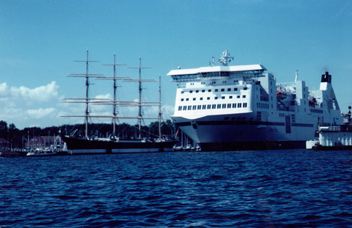
Mouth of the Trave River - a very narrow affair
A bit later I passed by the ferry terminal and saw those big ferries turn around in a wider part of the river. Right there, a bit upriver from the last ferry dock, was a small beach, no signs, no wildlife preserve, no access from the road: another perfect place for my tent. The boatshow that afternoon was stupendous: sailboats and freighters were coming and going, but only very few powerboats or launches as they are known around Maine (gas is very expensive in Germany). The big show, however, were the ferries, turning 180 degrees on their own power, with thrusters fore and aft - no tugboats.
Tomorrow was only half a day, 13 miles upriver to the city of Lübeck and our rendezvous at the “Holstentor”, the old brick gate, the symbol of this venerable 1000-year- old city. That would end the first part of my trip, the coastline from Denmark to the former border with East Germany, which used to run right by the “Passat” windjammer, i.e. the Baltic coast of the old Bundesrepublik/West Germany.
The Trave was quite beautiful till you come to the Flender shipyard and the industrial port. But I wanted to go up the river to the center of town, the old city, which by the way was built on an island in the Trave for protection, and was walled to boot and had huge gate houses, the Holstentor being the biggest of them. Lübeck was the hub of the so-called “Hanseatic League”, a trading union of some 200 cities stretching from England, Holland and Norway to Russia. Its heydays were from about the 12th to the 17th century, and one of the major trading commodities was table salt.

Holsten Gate, Lübeck
The cities even developed their own type of boats for the trade, the smaller older clinker-built “Kogge”, and the later and bigger “Karavelle”. A group of volunteer boat builders was just now building a replica of this boat in the inner harbor. I then made it under a low swing bridge into the Old Timers harbor, where all the old wooden sailboats were moored. Since I was ahead of schedule, I filled my time with writing my trip log, having a snack, taking pictures, poking into other harbor basins, so I would show up at exactly 12:00 noon under the designated bridge near the Holstentor.
Reimer was there with roof rack, straps and all. A perfect ending to a very successful first part. 235 miles in ten and a half days; 23.4 miles on average for the day as planned, right on target. No mishap, gear breakage or scrape, not even a blister. Only my bread did not survive the trip. But PB&J on Swedish Knäckebrød isn’t bad either. The boat proved to be extremely seaworthy, stable and forgiving, even in the roughest conditions. Into the wind with a full load, paddled by only one person, it needs power to move forward though. All my tweaky adjustments worked great, especially the deck over the bow and my foam hip pads. But the most important gear item was my paddle. Thanks, Zaveral, for personally seeing to it that it got to Germany fine and on time.
Now for the big party, the official reason why I came to Germany. But if you promise not to tell my sister, I can’t wait to start out again and paddle the second 200 mile stretch along the coast of former East Germany, to the Oder-Neiße Line, the border with Poland.
SOLO ALONG THE BALTIC COAST OF GERMANY
PART II
LÜBECK - AHLBECK
Former communist East Germany
The big family party ended early this morning and was a great success. After a couple of hours of sleep, however, I started packing for tomorrow’s 6:45 a.m. start at Travemünde. I decided to save myself retracing the 13 miles down the Trave River and start instead right beside the “Passat” windjammer at the very mouth of the river.

Windjammer Passat
The first 14 miles of coastline were a stark contrast to the busy, affluent resort areas to the west of the Trave. This coast was literally empty, hardly a house or hamlet in sight till you reach Boltenhagen. People must have been kept away from the border to the West. A couple of watch towers along the beach were a grim reminder of this country’s most recent past. I suddenly remembered reading that these buffer zones, as well as the restricted areas surrounding the access roads to Berlin, have in turn become havens for wildlife, unintended nature preserves, if you will.
At Tarnewitz Point, separating Boltenhagen and Wohlenberg Bays, I saw my first German eagle EVER, a “Seeadler”, a sea eagle, which looks very similar to our American bald eagle: same size and build, even some white on its tail, but not the head.I saw it several times, very clearly, perched and in flight with its broad straight dark wings. It was an eagle. And it was around a former military installation with restricted areas all around it. I felt it was there just to prove this point. And since I had paddled my set miles for the day, I pitched my tent just south of the still closed harbor on a minimal beach surrounded by reeds. That afternoon, after the rain stopped, I enjoyed a chorus of birds, the likes of which I had never heard before. Even several ravens joined the chorus. I was impressed.
Wismar is the first larger city to the east of Lübeck and has a large shallow bay and a large island at its doorstep. The wind was freshening from the SSW, and I had an exciting ride to the narrow channel behind Poel Island. I would have to hole up in the last bight at the end of this channel, because to the north was first a bird sanctuary and then a 5 mile nature preserve extending a mile and a half into the sea. If that was not hard enough to get around without violating any laws, the shore plus a mile and a half out was labeled “Sperrgebiet - Munition”, which means as much as watch out for unexploded ordinances, or better yet, stay out. I would have to negotiate this problem early in the morning, real early.
Unfortunately it was raining and the wind was quite fresh (which meant whitecaps) and there was no way for me to stand off shore over a mile. So I tip-toed and danced through the tulips, being ever so watchful for any floating object as well as chase boat. (I obviously made it, otherwise you would not be reading this.)
At Trollegrund, “troll ground”, I headed east, and the wind turned with me. At the point some surprisingly large waves were forming, but I had to turn my tail to them, which I never like, because I cannot see them coming. Then suddenly it happened: my stern is lifting more than usual, my boat begins to glide, faster and faster like a surfer or like a runaway truck - I AM SURFING - with all my gear, for the first time ever, at a speed I am not familiar with.
The boat begins to turn left into the trough. The words broaching, rolling, washing machine raced through my mind. OH NO, I shouted and wrenched the bow back and kept bracing. By then the breaking part had caught up with me and rumbled under the boat while I was leaning back as far as I could while still holding my low brace. After about 20 seconds the show was over - I had to take a deep breath and wipe some sweat off my forehead though.
The rest of the day was less exciting. Kühlungsborn and Heiligendamm were two of East Germany’s major Baltic resort towns. As a matter of fact, Heiligendamm claims to be the first spa ever on the German Baltic - and it showed its age as all GDR (former East German) towns do. A lot of new building, reconstruction and remodeling is going on everywhere. There is a distinct need to catch up to the glamour and affluence of the old Bundesrepublik (former West Germany), and there is envy on one side and bickering as to who is going to pay for it all on the other, and it still overshadows the otherwise happy unification process, even 12 years later.
Wind bound
My overnight spot was nothing special, but very serviceable, with rows of wooden breakwaters extending straight into the water. It rained again and the wind kept up, even the next day to Graal Müritz. I had to make an exciting surf landing on the beach and weight down my tent before I could set it up. At times I wondered whether my tent was going to be reduced to a tarp. It caved, buckled and slapped, but stopped short of ripping to shreds. The later the afternoon, the worse it got. Needless to say, I did not get much sleep, also because the air was filled with the finest of sand, which sifted through the vent screens onto everything inside my tent.
Wind-bound in Graal Müritz
The morning was even worse. The ocean was white as far as the eye could see. In places the beach had been swept clean of fine sand, and rocks were appearing, while behind my boat and tent, little sand dunes were forming. This was clearly a no-go situation; I should not even be on this beach totally unprotected from the wind. I literally grit my teeth and got back in my sleeping bag.
At 7:00 p.m. the wind finally let up a bit and by next morning the storm had blown itself out, leaving a mess of seaweed on the beach. I felt I had to hustle to make up the lost day and was on the water even before my usual 6:00 a.m. It was a long 14-mile haul to Darss Point and a long way around the shallows surrounding it. I passed close by “Bernstein Insel”, Amber Island, looking for that precious, golden gleaming jewel made by nature millions of years ago from the pitch of conifers, but found none. Instead I again saw lots of stately swans drifting by with their young in tow. But I was pushing on, along a seemingly endless beach running straight to the east. I
It was Saturday, the sun had come out, and so had the people. I wanted to go to the edge of the large Nature preserve to get a good head start for the difficult rounding into Stralsund tomorrow. So I set up my tent just beyond the last beachcombers, who often set up little colorful nylon wind screens or tent shells. No sign or fence for the Nature preserve. So I had to still be outside of the park and legal, marvy.
Caught by the “Strandpolizei”
Then suddenly out of the blue a severe thunderstorm hit, just as I had put up my tent. And the wind was rising again and kept up all night. At 10:30 p.m. two uniformed guys with bright flashlights informed me that I was camped about 300 yards inside the park and had to move. That was a good one, and I tried my best to talk myself out of it; but I had to promise to be off the beach by 6:00 a.m. next morning, weather permitting, I added.
The night was at least as windy as the night before, with sand drifting around my tent and boat. But at 6:00 a.m. the wind had suddenly calmed considerably and I was off; first, 5 miles along the preserve, and then around the biggest sand bank I had ever seen - 6 miles long and a mile and a half wide, which translates into breakers on all sides. It was a long hard and tense haul, because the wind had picked up again and I was dancing. Rounding the last point, I was rewarded for my efforts with my second eagle sighting and even a wild boar. That cheered me up, but I still needed a break.
Down the Strelasund to Stralsund and Greifswald
The rest was easy: down the Strelasund to just before the city of Stralsund. I even found a tiny beach under a tree with the silhouette of the city in my tent door. Perfect. I had decided not to go around the large island of Rügen, which would have added at least 70 miles to the trip, and time was running short. I had to get back to Maine to teach summer school.
Stralsund is another significant city of the old Hanseatic League. (So were Wismar and Rostock, which I passed by earlier.) Its gothic brick town hall and church are massive and a proud expression of former wealth and greatness. But needs and styles change. A newish looking humungous shipyard building now dwarfs the entire city and, in my eyes, is a major distraction. But I admit, it must be nice to be able to build a 10,000 to 20,000 ton (PANMAX) ship inside a 330- yard long and 119-yard wide construction hall. (Just imagine, 6 football fields under one roof!)
I also noticed an icebreaker moored next door, which reminded me that the Baltic freezes over in a severe winter, and shipping lanes have to be kept open by huge icebreakers. The salinity in these waters is low due to the restricted outflow of the Baltic north of the Danish islands in the Kattegat-Skagerrak area. For the same reason, tides are practically non-existent. They are higher near the Kattegat, but in these waters negligible.
All that people are concerned about here are “wind tides”, storm surges: water that is pushed into the shallow bays by strong winds and then sloshes over the edge. Therefore most of the lower coastlines have dikes or artificially created beach dunes. For a small boater this is ideal and easy, compared to what I am used to on the Atlantic and the Bay of Fundy in Canada.
Next day took me 32 miles down the sound towards Greifswald and beyond. It was a quiet paddle with little excitement, except when I got to Riems Island. “Seuchenschutzgebiet, dangerous, keep out” were printed on my chart. An infested island or quarantine station? It couldn’t be a leper colony, could it?! I found out after the trip that there was a research facility on this island studying Mad Cow Disease and they did not want anybody in the vicinity. Not knowing this, I checked out the ducks and swans around the island, and determined they looked healthy and normal and could survive whatever was in the water, and so could I, I thought bravely. I gave the place a wide berth though, always looking for oozy, slimy sludge and marker buoys, but there were none.
I had to stay off the next island also since it was yet another nature preserve, but eventually I made it into Greifswald Bay, a very shallow one at that, with serious algae bloom, surrounded by tall reeds, the type used for thatching houses. But a rather large deeply forked red-tailed bird of prey (Gabelweih/Roter Milan - a kite) led me across the bay to a much steeper, pine-clad shore with a beautiful beach. It was perfect, and I saw that bird and a couple of ravens several more times from my tent which blended perfectly with its surroundings, down to my green boat on a patch of lush green beach vines.
This was the longest paddle of the trip so far, 32 miles or 51 km, but by far not the hardest. I was beginning to make up the 0-mile wind day. Two more days to Ahlbeck and only one more overnight. The trip was winding down. Tomorrow would take me across to the island of Usedom and just north of the resort town of Zinnowitz.
And this is exactly what happened. I passed by a “decommissioned” nuclear power plant, but I noticed a lot of activity at the huge plant site and heard a lot of deep industrial rumbling and electrical noises. Even the private harbor entrance was being dredged. It looked very active to me, and I felt a bit uneasy passing so close to a communist-built major nuclear power plant. Chernobyl was still too vividly in my mind. Then I saw three German eagles floating, gliding, soaring above the adjacent marshland, and all my worries were wiped away.
Historic Peenemünde
When I crossed the mouth of the Peene River to get to the island of Usedom, recent history overcame me. This was Peenemünde, the rocket research center and launching site of Hitler-Germany’s rocket program. It was here that Wernher von Braun tested his V1 and V2 rockets which later harassed London and other British cities. (For the bombing of Coventry, the RAF retaliated and destroyed 20% of the city of Lübeck in one night.)
I was having lunch holding on to the very edge of the runway the spotter planes must have used to check on the new rockets’ accuracy. When asked after the war about his involvement with government policy, von Braun brushed it off: “I only send them (the rockets) up. Where they come down is not my department.” As we all know, he eventually ended up in Huntsville, Alabama and became an American citizen and the US design chief who eventually sent Neil Armstrong to the moon in basically his design, the Saturn V rocket.
And while I was shaking my head about the strange ways history takes, I saw my three eagles again, plus a fourth one, soaring above this very runway and area of destruction. Four eagles over Peenemünde, that has to be a good sign for the new Germany and a peaceful Europe.
Usedom’s perfect beaches
The shallows around the point were extensive. I had to go out several miles and then some to get around the wrecks of several freighter hulks. I have no idea how they got there, whether they foundered in the shallows or were targets from the Hitler or East German regime. At that point I did not care, but wanted to get to my take-out for today, which was not going to be easy because it was getting real hot, and the wind was piping up from the SE, following the shore perfectly.
I passed the most beautiful beaches so far, wide and white, rimmed with undulating dunes sparsely covered with beach grass. Vacationers were out on the beaches and in the water. I had to stay outside the buoyed areas, but I did it gladly to avoid the noise and blatant nudity. At Zinnowitz I stopped one mile before the boat landing pier where excursion boats came and left all afternoon.
I pulled up high on the beach near the dunes at the edge of the grasses and sweltered. I heard later that my sister and her husband wanted to surprise me again with lunch and coffee, but they never found me, even though I had told them exactly where I was planning to stay: 1 mile NW of the pier. Other people, though, found me (mostly men), and wanted to know all about my trip and the boat, standing in the buff in front of me, while I was sitting on my low Crazy Creek chair in my tent - a very uncomfortable situation for me.
17 more miles to Ahlbeck! I had figured out my departure time so I would arrive exactly at high noon at the pier, plus one hour for breaks and unforeseen delays like a headwind. But instead, the wind came from the NE, onshore and a bit from behind. In order to go straight, I had to paddle much harder on my left, and when the wind increased and the waves began to break, I had to paddle even harder, even sprint to outrun the breaking parts of the waves. So I ended up in Ahlbeck much sooner than expected. I was not going to dilly-dally just to show up on time. At one point I even worried if I could make it there at all. But I quickly dismissed that notion and dug in harder.
I rounded Ahlbeck pier when a customs officer stepped out of his house and asked me sternly where I was going, etc. I was delighted to find out that this was the official check-in/check-out point on the German side of the border. He then seemed to enjoy that I had made it from one German border to the next in that little open boat. “Gut gemacht - Well done!” in a very official voice were his only words as he waved me past, watching me head for the beach on the “Poland side” of the pier.
By now the waves were really breaking and I had to get through four sets of breakers. One of them almost got hold of me and was about to toss me unceremoniously onto the beach. But I had my pride that that would not happen and jerked the boat straight with a mighty pry and a last low brace. I had landed! But I had to quickly drag the boat onto the beach before it filled with water.
End of trip – my grand arrival
Nobody was there to greet me, nobody I cared about saw me come in. Too bad. I took a hand-held shot of my grinning self, capturing the feeling of elation on film.
Then suddenly my sister arrived, shocked that I was already there, and why could I not have waited and arrived when I said I would ... And then she disappeared and moments later returned with a newspaper reporter in tow, digital camera and notepad in hand.
The article in the local paper came out fine and shows me sitting in my beached canoe, grinning, weighing my Zaveral paddle on my knees as if it were a Viking sword. I then enjoyed some “Kaffee und Kuchen”, real coffee and a piece of cheesecake in the beach café, before we packed up and loaded the canoe on their fancy Saab. And while we were careening through the countryside on our way back to Lübeck, the car phone rang: it was my dear wife Nancy, calling from Orono, Maine. My trip was now complete.
Arrival on the border in Ahlbeck
440 miles (700 km) in 20 days total, averaging out to 22 miles a day - not too shabby for that boat and those weather conditions, and considering that one day was a no-go wind day. But the real importance of this trip for me was not how far and how fast I paddled; it was experiencing the entire German Baltic coast with all its official and personal history.
Neither was it a nostalgia trip, but rather a trip of understanding of Germany’s and my past and the way they are intertwined. Sure, I also liked the raw paddling experience on this 12,000-year-old glacial melt-puddle, and yes, I delighted in showing Germans how we Americans paddle open canoes in the US and Canada, but that was not the main focus of my trip.
I think Nils Holgersson and his German “cousin” Peter Jünk would be proud of me for finally at age 63 fulfilling my boyhood dream of seeing the shores of the sea surrounding my childhood world and seeing it open to encompass the world.
Info:
Charts: Sportschifffahrtskarten, Ostsee (set 1,2,4)
by: Nautische Veröffentlichung Verlagsgesellschaft mbH, Arnis, Germany
www.boat.de/clown/inv.htm
Info books on the Baltic: HB Bildatlas Ostseeküste Schleswig-Holstein
HB Bildatlas Ostseeküste Mecklenburg-Vorpommern
August Clausen: Peter Jünks Reisen mit der Silbermöwe. Verlag Heinrich Möller, Rendsburg. 1936/65
Selma Lagerlöff: Wunderbare Reise des kleinen Nils Holgersson mit den Wildgänsen.
Gear: OLD TOWN Penobscot 16 canoe
Zaveral bent-shaft carbon fiber canoe paddle
Ritchie Canoe/Kayak compass
Iridium satellite phone (for brief outgoing calls only)
Regular camping gear from US in two duffles; local canned food
© Reinhard Zollitsch
BACK TO TOP OF PAGE