A Retrospective
20 years of solo sea-canoeing around New England
and the Canadian Maritimes 1996-2016
Tempus fugit – oh, how time flies! Any of you readers out there above 50 can empathize with that opening statement of mine. All my life I have been looking forward (except for when I am in a rowboat) to starting new chapters, always eager to see what is around the next corner, the next bend of the river or point of land. Now at 77 I catch myself looking back over my shoulder more often, reflecting about what I have done/achieved, and wistfully noticing what has grown out of reach for me to accomplish in the years to come.
Have no fear, I'm not about to bore you with a complete biography, but only give you a brief reflection on my most recent chapter, which, when I started it in 1996, I never thought would be as important to me as it turned out to be. It was intended only as an addendum to an already full life. Nancy and I had raised 4 children, I was almost ready to retire from the University (in 2004) after teaching there for 42 years, and I had also been successful in various sports: this was time for the fun part of life, for "slowing down and taking it easy..." Looking back, though, I notice that the past 20 years have become a defining part of my life. That this chapter would include history, was the biggest surprise for me, since I hated history in high school: nothing but wars, conquests, subjugations, exploitation – a lot of inhumane stuff and suffering, if you know what I mean. But getting back to my personal story, the following is "how it all began".
Trip planning
Going "downeast" all the way, for starters
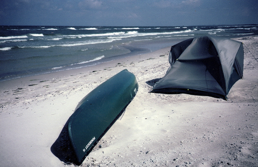
I had heard about the newly formed Maine Island Trail Association, a stewardship program with a water trail along the coast of Maine from Portland to Machias. What a great idea for a person interested in ocean boating and camping. I joined the group and paddled the entire 300-mile trail in my open solo whitewater racing canoe - not the best choice of boat for the open ocean, I have to admit, but that was all I had at that time. (Note: Please do not try to duplicate that feat! A sea kayak would be a much better bet.)

My first Maine Island Trail trip
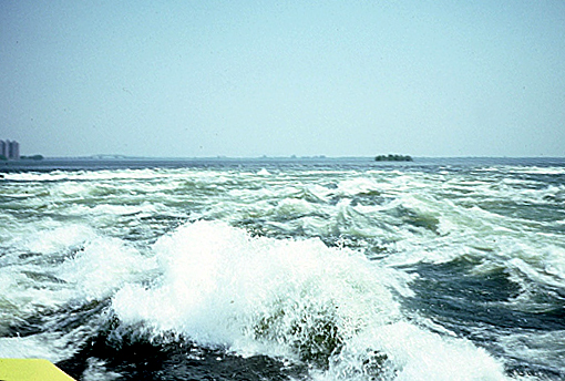
Being a logical person, I then extended the venue, first to the south: paddling all the way "downeast" from Boston, MA, where the concept "downeast" originated. Schooners sailed down wind (before a prevailing SSW breeze) in an easterly direction. With the 20° variation (compass correction in this area), the actual course sailed would be close to 90° magnetic, i.e. due east). I then checked out the "northern extension of the MIT", paddling down the entire St. John River to St. John, New Brunswick, as a warm-up, and from there back to Machias, ME, riding the "Fundy Bay ebb-tide express". Great fun!
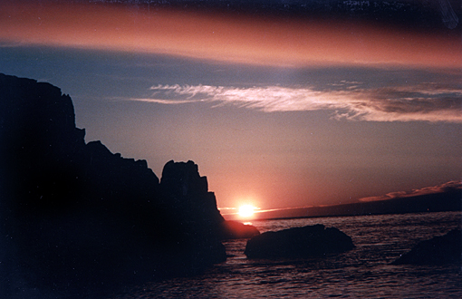
Sunrise, way downeast
The big one – a 1000-miler
After those trips I was ready to tackle the BIG one, a 1000-miler. It was 1999, and I had read a lot about Samuel de Champlain, even got his diary out of our library, and decided to paddle the reversal of his 1609 trip down Lake Champlain, departing from Tadoussac, on the St. Lawrence River. So I started out in Whitehall, NY, went straight north up the entire big lake, then down the Richelieu River into the St. Lawrence at Sorel, hung a right till my 1000 miles were up. That took me past Québec City, around the steep and stunningly beautiful Gaspé peninsula all the way into Chaleur Bay and Matapédia eventually. What a trip! Québec was my only resupply stop-over - no marinas, no campgrounds, just beach camping after averaging 27 miles per day. Not too shabby for a 60-year-old!
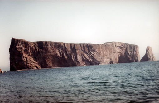
Percé Rock
A thousand-mile smile
Looking at the map that winter, I noticed with glee that I could go on, go around Prince Edward Island, along New Brunswick's Gulf of St. Lawrence coast, and eventually on around Nova Scotia. A short ferry ride from Digby, Nova Scotia to St. John, NB would get me back to familiar shores. All I needed to do to complete my 4000-mile circumnavigation, was to close the 500-mile gap between Lake Champlain and Boston (via the Hudson R. to New York, and on through Long Island Sound to Cape Cod and Boston eventually), which I did in 2005.
 Click to enlarge map
It was a big, significant trip, especially going solo and totally unassisted in a covered, 17' solo sea-canoe, a Verlen Kruger designed and built SEA WIND. A big THANK-YOU goes to Nancy for letting me go and supporting me in my venture, and being willing to car-shuttle me and my gear to my put-in spots and picking me up at the end of each trip segment. I could not have done it alone. I feel very fortunate and grateful. And so that she and the rest of my family would hear and learn more about my trips, I started writing them down in article form for various boating magazines, here in the US, in Canada and even in Germany (German being my native language).
After publication I would then put them all with charts/maps and lots of pictures on my website www.ZollitschCanoeAdventures.com so that anybody interested in canoe-tripping could read about those venues, totally free of charge.
More historic tides
Champlain was the first historic explorer who fascinated me. In 2004 I checked out his 1604 first landing in Nova Scotia on Cape La Have Island and followed his route around the South Shore and Cape Sable Island into the Bay of Fundy to Digby, a most challenging shoreline, to say the least. Later that year, I also checked out his first settlement on St. Croix Island in Passamaquoddy Bay between Maine and New Brunswick (in 1604, exactly 400 years ago), and came up with some solid climatological reasons why that settlement failed so miserably. History books want you to believe that there was an "exceptionally strong north wind blowing that winter". Nonsense! The French sailors brought along their European concept of what winters would be like at 45° north latitude. Coming from France, which has a relatively warm ocean to its west (the weather-maker side), plus the Gulf Stream, the sailors simply assumed Maine was the same. They learned the hard way that 45° N in Maine is not the same as 45° N in the wine-growing province of Bordeaux, France. Maine has a cold continent to its west with significantly colder temperatures, since land cools off much faster than water. It was a major climatological miscalculation, rather than a stronger than usual north wind, that made the settlement fail.
As Jacques Cartier had done before him (1534), Champlain was also obsessed with finding the Northwest Passage, a seaway to the riches of the Orient, China and Japan. Both thought to have found it with the St. Lawrence River, which they followed all the way to the significant rapids in Montreal. They named them the "Lachine Rapids", the "China Rapids", since they believed China was just beyond the falls.
Lachine Rapids
I had to see this historic spot, or even better, "run the rapids" in my little sea canoe, if I could. As always, I don't just drive or fly to a spot like that to check things out, but make a real trip out of it, so I could experience the place first hand. And since Champlain in one of his later travels made it all the way to the Great Lakes, why not start there too, at Cape Vincent, NY, the beginning of the St. Lawrence River. And why not go all the way to Québec (350 miles), which happened to be preparing to celebrate its 400th birthday in 2008 - founded in 1608 by Samuel de Champlain, of course.

Down the St. Lawrence (put-in at Cape Vincent)
Speaking of Samuel, he had already started the first European trading post on the St. Lawrence, in Tadoussac (in 1600), and also explored the unique, spectacular Saguenay Fjord there. Yet another excuse for me to paddle along the North Shore from Québec down to Tadoussac and up the Saguenay to Chicoutimi (208 miles, in 2009).
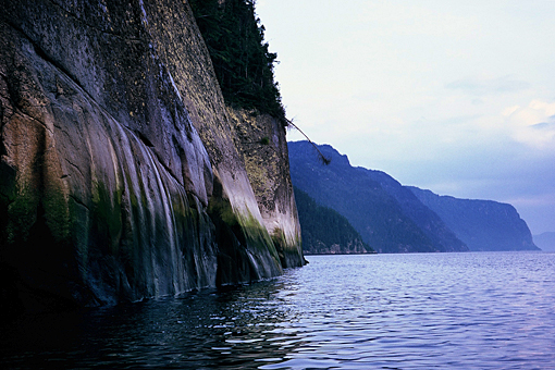
Up the Saguenay Fjord (Cap Éternité)
Paddling down the entire Hudson River in 2005, checking out the newly established Hudson River Water Trail (fashioned after our Maine Island Trail) as well as thinking about Henry Hudson's desperate quest to find the NW Passage, I saw first hand what made Hudson think he had finally found the fabled passage: here was a wide and deep river "that flowed both ways" ("muhheakunnuk" in Algonquin). It seemed more like an ocean arm than a river. Correct! The Hudson is not a typical river; it is a "drowned river" (drowned by the rising ocean) and is thus tidal, an estuary, all the way up to Albany/Troy, 160 miles. But it runs straight north/south, not northwest. Someone should have noticed that and told the skipper.
John Cabot's first landing in the new world
I have always been fascinated with John Cabot's first landing in the New World in 1497, but so little is known about it. Historians don't even agree where it could have been. Was it on the northern tip of Newfoundland or the northern tip of Cape Breton Island, Nova Scotia, the two most likely landfalls? So after I had finished my big 4000 mile loop around New England and the Canadian Maritimes, Cape Breton Island and Newfoundland were always on my mind. I had not "done" them. They were simply too far away and too challenging for a solo unassisted paddler, or were they?
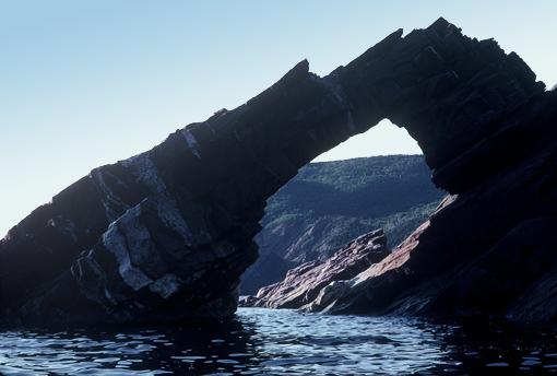
Stone arches in the Cabot Strait (Cape Breton Island)
Well, in July of 2007 I was all packed up to drive (solo) to the causeway to Cape Breton Island. I then paddled up the western shore in view of the Cabot Trail into Cabot Strait, feeling very much on historic tides. What an island, what a headland! It must have been visible from sea for over 20 miles. 340 miles and 16 days later I was back at the causeway. It was my most challenging as well as most beautiful circumnavigation so far. Certainly one of my all-time high points.
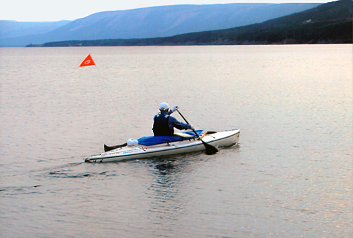
Questing for John Cabot's first landing in NFL (start of trip)
And yes, you guessed it, the next year (2008, at the ripe old age of 69), I took the ferry from Cape Breton Island across the Cabot Strait to Port aux Basques in Newfoundland. I paddled another 320 miles, or 16 days, along the Côte des Basques into the Strait of Belle Isle, and to the tip of the Great Northern Peninsula of Newfoundland, to L'Anse aux Meadows eventually. It was formerly known in French as "L'Anse aux Méduse", I researched - the "Bay of Jellyfish", not grassy "meadows". Today's name is simply a British linguistic corruption (they heard "meadows" in the French word "méduse"). There simply are no meadows, only 60 miles of flat tundra, moose country. That the Vikings were supposed to have landed there around 1000, was another reason for me to see that place. I had grown up in northern Germany near Haddeby/Haithabu (near Schleswig) on the Jutland Peninsula, the Viking thoroughfare from the Baltic to the North Sea and the Atlantic eventually.
If you readers want to find out why I strongly believe Giovanni Caboto (John Cabot's birth-name) landed on Cape Breton Island and not on Newfoundland, read my article "John Cabot's Prima Terra Vista" on my website. You might also find out why he headed for the northern tip of Newfoundland in the first place, why he did not land there, and why he never talked to anybody about this trip, except for the king of England, who commissioned this trip. It was a most fascinating detective story for me.
Other historic trails
There are two more trips that stand out in my memory, both in a solo open Old Town Penobscot 16 canoe. I grew up in Kiel, Germany along the Baltic Sea, and since childhood had dreamt of seeing the entire shoreline of Germany from Denmark to Poland, all 700 km (438 mi). This first became possible after the unification of East and West Germany in 1990. 2002 finally was the right time for me. I had been summoned to a significant family party in Lübeck, Germany, the half-way point of my intended trip, was able to persuade my sister to car-shuttle me to the Danish border for the start of my trip and pick me up at the Polish border, if I promised to attend her party. I even found an Old Town Canoe dealer in Hamburg, willing to lend me a Penobscot 16. And paddle-maker Bob Zaveral mailed me one of his carbon-fiber bent-shaft beauties to Lübeck, since I could not fly with it, this being just after the New York 9/11 disaster.
Windy Baltic Sea at Graal-Müritz
It was a very sobering as well as educational trip for me, comparing the coastline of affluent West Germany (the Federal Republic of Germany), with that of communist East Germany (the so-called German Democratic Republic). The shoreline was very pretty, though, with lots of beaches and people, which made stealth-camping very challenging for me. The good thing: there were no tides, for a change.
The other historic trip was in 2003: a 150-mile river sojourn down the Upper Missouri River in Montana, starting at Great Falls. The years 2003-2006 marked the bicentennial of the Lewis and Clark expedition from the Mississippi to the Pacific Ocean and back. They left a wonderful, explicit, and easily available diary of their trip. I was fascinated by their descriptions of the scenery, the flora and fauna, the wildlife, and the native people. I couldn't wait to relive part of their adventure. The stretch up to the continental divide, the "ten miles of waterfalls" near Great Falls, where their month-long portage started, interested me most. So I rented a Penobscot 16 from an outfitter there, and paddled and camped on the same days and many of the same spots as L&C did. What a remote and utterly fascinating world I saw! It also turned into the trip on which I myself learned the most about geology and history. Fascinating stuff!
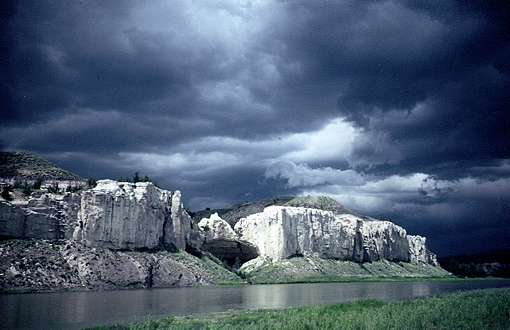
L&C stopped here (Eagle Creek/White Cliffs, Upper Missouri River)
The Everglades and Suwannee River
In the spring of 1992 I was tired of seeing my students having "fun in the sun", in Florida that is, so I decided to find my own type of fun, paddling the entire 100-mile Everglades National Park water trail from Everglades City to Flamingo. I called it my "Allagash South" venture, after our 100-mile wilderness waterway in our Maine north woods. I had read Marjory Stoneham Douglas' book The Everglades: River of Grass, and several others and felt challenged to find my way through the maze of mangrove islands, rivers and lake-chains, including the "Nightmare", without a guide, all by myself. And what an experience and adventure it was. It is still one of my favorite spring paddling grounds, only now I mostly start in Flamingo, loop around Cape Sable on the open Gulf of Mexico to the very top of the park (Tiger Key), only to crisscross my way back through the mangroves to Flamingo. Remote overnights like Sweetwater, Willy Willy and Canepatch (former Calusa Indian sites) are some of my favorite stop-overs for the night. Navigating without GPS, only using the old historic dead reckoning method (chart, compass and watch), is very challenging, which has always appealed to me. Most stretches I now do just from memory, like the old-time dwellers in the Glades: Lopez, Watson, Darwin, Totch and my friend Thornton, whom I met on my first trip in the Glades. There is so much history, beauty and tranquillity there - I love it.
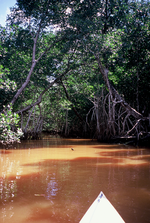
The Nightmare, Everglades
And since in Germany, the favorite song in our high school English class of all boys was Stephen Foster's "Old Folks at Home", which starts with the swoopy: "Way down upon the Suwannee River...", guess what? I had to finally see it and do it, from the very top, where it comes out of the Okefenokee swamp, to the Gulf of Mexico at Suwannee, what else. What fascinated me most on this trip was the limestone canyon I came through. It felt like paddling through a coral reef, where someone had let out the water, like a dry-dive, if you know what I mean. I saw fossilized shells in the walls, grottos...the works. Yes, the Floridian peninsula used to be an ocean floor, coral, which was raised and then tilted slightly.
Believe me, when Florida celebrated its 500th birthday in 2013, I was there to celebrate it also, only I did it my way, with yet another 2-week solo canoe trip through the Everglades and, of course, Ponce de Leon Bay. In 1513 the Spaniard Ponce de Leon had landed on Florida's Atlantic shores, on Easter, as his report states, on "pascua florida – the feast of flowers" (the Spanish name for Easter). So he named the peninsula after the historic date he landed there, not after the many flowers he may have seen there, which most Floridians (and the rest of the world) think.
Crossing the "Pond"
The biggest trips, though, were made on sailboats, crossing the Atlantic, west to east. Both voyages were made on classic boats, both in honor of my paternal grandfather, the old sea captain, who had rounded Cape Horn several times on his way to Chile, and the Cape of Good Hope, on his way to Australia. My first crossing was in 1977 as a watch captain, responsible for wood and canvas (boat and sails), on a classic 45' wooden Boston pilot schooner, with the for me uncomfortable name "Fiddler's Green" (the sailors' nirvana...after they died, with the grim reaper joyfully playing his fiddle for the lumbering sailors). I felt a bit queasy. But I had to admit, the Pete Culler designed, classic schooner looked beautiful and sturdy, and I am not superstitious, I had to tell myself. (By the way, Nancy did not like that name at all! I don't blame her.)

Fiddler's Green across the Atlantic (RZ at the helm)
We started our voyage right here in Camden, Maine and sailed non-stop (25 days) past Nova Scotia and Newfoundland, across "The Pond" towards Ireland, and into the English Channel, to tie up in St. Malo, France, Jacques Cartier's home port, eventually. The new owners of the boat were French, spoke little English, and had major marital problems. Being hit near Sable Island (off Nova Scotia), the "Graveyard of the North Atlantic", by a 60-knot storm, which lasted 36 hours, was terrifying, to say the least, especially with an inebriated skipper, who would not let me reef in time. With all sails down but a triple-reefed foresail, we lost all control of the boat and were at the mercy of the waves. I never want to go there again, for sure! It took me 25 years to finally be ready to write down the entire story. Whew!
But then in 2011 I found out that the 60' yawl, that we students from the University of Kiel, Germany used to sail on, was still afloat. Actually, the 1936-built boat was bought by a young, energetic skipper in 1991, was fully refurbished, and crossed the Atlantic every other year to charter in the Caribbean. And there she was in April 2011, getting ready to leave Antigua and return to Hamburg, Germany, with a brief stop-over on the Azores Islands (off Portugal). The boat was the old "Peter von Danzig", now "Peter von Seestermühe", celebrating its 75th birthday and its 25th Atlantic crossing that year. I still had great memories of our 5-week student sailing trip in 1961 (exactly 50 years earlier!), to Scotland, the Shetland Isles, Norway, Sweden and Denmark. The boat was solid as a rock, even in force 11 winds off Edinburgh.
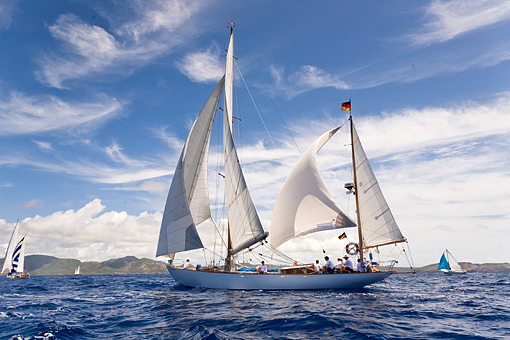
Peter von Seestermühe off Antigua (start of Trans-Atlantic voyage)
I had no trepidation signing up on that boat. She was originally designed for the opener sailboat race from Bermuda to the site of the 1936 Olympics (in Berlin and Kiel, Germany). A trip from Antigua via the Azores to Hamburg sounded like a dream trip...a couple of e-mails later (and a thorough check-up of me on my website by the skipper), and I was on. I was one of the 6-person crew. And what a trip it was: 5000 miles in 5 weeks. We sailed her hard, even with spinnaker, past midnight at times. We never got more than 40 knots of wind, and were always under control, unlike on the schooner "Fiddler's Green". We even celebrated my 72nd birthday on the Azores. How cool is that! But I am afraid that was my last Atlantic crossing by sail. A Boeing "Triple 7" sounds better, safer and more comfortable at age "double 7".
To sum it all up (in summation):
I am amazed myself about what a significant chapter the past 20 years of my life have turned into. There seems to be a distinct thread running through all my coastal canoe trips, namely the history of our early explorers. As Robert Frost once put it, "one can do worse than be a swinger of birches". I for my part feel I couldn't have done much better than following in the footsteps of John Cabot, Jacques Cartier, Samuel de Champlain and Henry Hudson, just to mention a few of the major players in my adventure trips.
So, you boaters and readers out there, enjoy my write-ups (81 by now on my website), and use them as motivational material for your own adventures. Despite our highly mechanized and controlled life these days, you can still find plenty of adventure out there, especially on the oceans. Be prudent and safe, but most of all HAVE FUN! I certainly did and still do, and I hope it shows. And don't worry about me: I've already planned a lengthy canoe trip on the coast of Maine for this coming summer, as well as racing the big bad Blackburn Challenge again, and paddling on Prince Edward Island and Nova Scotia.
I have also had a lot of fun writing up my stories, seeing them in print and hearing back from my family and friends that they like them, find them entertaining and even funny, and often also quite edifying. What more can a writer ask for, especially since English is not my native language, but learned in a German high school...and of course honed here in the US (since 1962).
Thanks to all of you out there, but especially you, dear Nancy, my staunchest supporter and love!
Cordially/with affection,
Reinhard
Reinhard Zollitsch
www.ZollitschCanoeAdventures.com
![]()
Click here for a printable version of this article
************************
BACK TO TOP OF PAGE