April/May 2013 solo canoe circumnavigation
On May 3, 2006 I was the first boat down the Allagash Wilderness Waterway in northern Maine. It was the first day the 100-mile park opened for the season. I certainly beat the blackflies and mosquitoes, as well as the throngs of eager, but also noisy, summer camp and boy scout groups. I enjoyed the cold solitude sojourn, and thought it might be fun also to be the first paddler of the year 2013 around Maine's largest lake, Moosehead lake (1266 square miles).

Click here to open a larger map
Official ice-out from Greenville to Mt. Kineo, the half-way point of the lake, was at 2:22 p.m. on April 28, 2013. "What about the northern half of the lake to Seboomook and the Northeast Carry, as well as for Spencer and Lily Bay?", I asked, but did not get an answer, only a cell phone number for the storekeeper at the Carry. He was not there and could not say. (Maybe he was in Florida, as so many Mainers are in winter; with a cell phone, you never know where the owners are.)
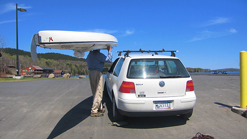
Anyway, the weather forecast for the following week was splendid. The last remnants of the winter ice would certainly melt by the time I got there, I figured confidently. I had a whole day to pack my gear and swing my 65 pound Kevlar solo sea canoe on my head in order to transfer it on top of my little VW Golf. Real early on April 30, 2013, Nancy and I were off from Orono, Maine to Greenville. She had decided to come along for the ride and also pick me up at the end of my trip, so I would not have to leave my car unattended for 8 days at the put-in ramp. Vandalism of personal property is getting worse, even in northern Maine – why chance it. Her instant reward for being such a supportive spouse was seeing snow-clad Mount Katahdin in the distance, and a big moose along the road on the way up and going home as well. A couple of loons and a gaggle of Canada geese made the put-in special, she quietly mused.

Put-in at the Greenville Junction ramp
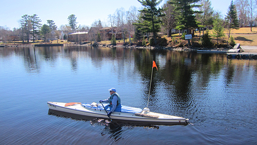
I am off!
The big lake looked great, uniformly rimmed with rich green pine, spruce, hemlock and cedar. All deciduous trees, the maples, birches, poplars, oaks, beech and ash trees, were still bare, waiting to show their green summer leaves and later their splendid colors in Fall. There were mountain ranges to the west, Moose Mt. (formerly Squaw Mt.), and an equally impressive mountain range to the east and northeast leading up to Maine's highest still snow-and-ice-capped mountain, Mt. Katahdin.
I put in at the well-appointed public dock at Greenville Junction, smack dab under the Canadian Pacific Railway bridge. My plan was to circumnavigate the large lake in a clockwise direction in 8 days, first, up the western shore to Seboomook and the Northeast Carry, then south again and into Spencer and Lily Bay and eventually back to Greenville. My first day's paddle was a 16 miler to Lambs Cove inside Sand Bar Point. When I circumnavigated Moosehead Lake in 1995, it had taken me 8 hours to get there; it was very windy (a strong NW 20), and I was paddling an open 16 foot solo whitewater racing canoe - not the best boat choice for a big lake (but back then, it was the only solo canoe I had.) This time, in my Verlen Kruger solo sea canoe, I did it in half the time, 4 hours, at my usual speed of 4 miles per hour (15 minutes per mile).
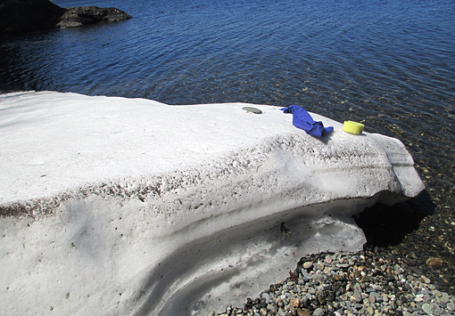
"Friendly" shore ice
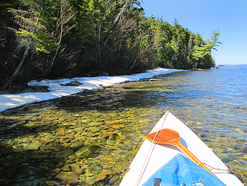
Ice was still clinging to the shoreline, especially in shaded bights facing north. Loons were everywhere, communicating with each other in that distinctive, eerie yodel-like song, which I still have not been able to duplicate. Along shore I heard several ravens, likewise talking to each other in their less melodious, raucous repertoire of much rougher sounding songs. Otherwise the lake was still. Fishing season would not start for another day, May 1. In the evening, a chorus of peepers and an occasional owl joined the loons, who kept up their songs all night. It stirred memories of previous solo trips to the north country, as well as family trips down the Allagash River and on Lobster, Flagstaff and the Rangely Lakes.
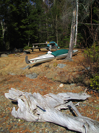
First overnight in Lambs Cove
Next morning greeted me with warming sunshine, since the night was cold, in the upper thirties. I wore my polypropylene long johns, polar fleece sweater and vest, wool socks and cap plus my aluminum-faced survival blanket over my mummy sleeping bag. My hot coffee tasted doubly good that morning and heated both me and my tent – I could clearly see my breath in the air before my face.
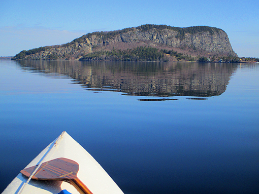
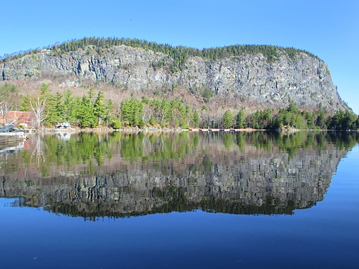
Drumlin-shaped Mount Kineo
It felt good being back in my boat with knee-high polar-fleece socks in my neoprene mukluks, Gore-Tex jacket over my long-sleeved poly shirt, poly gloves and warm hat, as well as my warming, zip-up life jacket. This was my Mt. Kineo day. All day I saw this distinctive, mid-lake mountain before, beside and behind me. It looked more like an over-sized glacial drumlin, having a steeper edge on one side, towards the east, and was gradually sloping down to the west. Only it was not made of glacial gravel and rock, but was a 700 foot high big chunk of igneous flint-like rhyolite. For over 11,000 years native Americans used this stone to shape arrow and spear heads and other tools, like ax heads and "ulus" (meat/fur scrapers; one of my favorite archeological terms, which I learned from my daughter Brenda, when she was working on a University dig around Gilman Falls/Old Town). Since I had climbed to the top of Mt. Kineo before with Nancy, I pressed on past the two Kennebec River outlet streams as well as the mouth of the Moose River into Socatean Bay, a very remote looking, deep bight, a good ways beyond Rockwood.

Into Socatean Bay
I found a lovely sandspit, littered with driftwood, where I blended perfectly into the scenery. I again enjoyed a chorus of peepers and frogs, as well as lots of loons and a family of ravens. Life was good, but a tad on the cold side.
Almost all next day I paddled northeast towards a surprisingly flat horizon. There were mountains on either side of me, but not ahead. Like the old steamship "The Katahdin", I was headed for the old logging station, Seboomook, in Northwest Cove. From here and other lake locations, this old steamship (built in 1914 by Bath Iron Works, Maine) was hauling supplies, livestock and passengers. Eventually it only hauled log booms to the sawmills in Greenville, as late as 1975. The "Grande Dame of the Lake" was then renovated, became part of the Moosehead Marine Museum, and in 1985 started "hauling" tourists to Mt. Kineo and occasionally also all the way up to Seboomook. Fall is a very special time to see this big lake, especially with all its colorful foliage. Both Nancy and I loved our fall outings on the "Katahdin" a few years ago.
Moosehead Lake splits into two bays up north, forming sort of a "Y", while the horizon is flat as a pancake. It feels as if the lake could spill over its banks towards the north, but no, it drains to the south, via the two outlet streams into the Kennebec River, which, as you know, empties into the Atlantic below Bath, at Popham Beach. Just north of the "Y" the map shows the West Branch of the Penobscot River, which has its own huge south-flowing watershed, emptying past Bangor and Bucksport at Stockton Springs into the Atlantic. As a matter of fact, there is a short 2-mile carry from the Northeast Carry into the upper Penobscot. Henry Thoreau and his Penobscot Indian guide Polis took this route in 1857 and even traversed into the next big watershed, that of the Allagash River, which flows into the St. John River, which, to nobody's surprise, empties into the Atlantic at St. John, New Brunswick, Canada.
Three significant watersheds are rubbing shoulders here in a very small area. I have jumped from one to the other many times, and each time, it was a most delightful thought realizing that I could have ended up in Popham Beach or Stockton Springs, Maine, or St. John, New Brunswick, depending on what brief portage I took.
Seboomook is not much to look at, but did you know that between 1944 and 1946 close to 1500 German POWs, mostly from Rommel's Africa Corps, were camped out here working in the surrounding woods cutting pulpwood for the paper mills in Millinocket? (I had not known that either, till I recently read about it.) So I hope you can understand why I would not feel comfortable camping out there.
Looking south from Seboomook Point
Instead, I decided to move on to Seboomook Point, at the center of the "Y". It has a most beautiful little campsite with a spectacular view down the big lake. Take-out is on a smooth, sloping slate ledge – a definite repeat in my book. I paddled today's 14 miles in only 3.5 hours, leaving lots of time for reading and writing. And I thought to myself, that Maine winters are very much defined by two data: first, the total snowfall of the season, indicating how much "fun in the sun" (make that snow) Mainers were having, skiing and snow-shoeing, but also how much shoveling and roof-raking had to be done, which could translate into an overall winter-fatigue and specific back and shoulder problems. Last winter's 78 inches of snow was a good winter, but some Mainers might disagree with me. I like both the fun activities as well as the shoveling and roof-raking, within reason: the work-out does wonders to keep me in shape for early spring paddling!
The second definition of a Maine winter is ice-out on Moosehead. You can go to the web and find out when that was, starting with 1848, 165 years ago. (Most dates lie between day 120 and 145 each year, counted numerically.) The later the date, the "harder" the winter was; in other words: the thicker and harder this big lake freezes over, the harder and longer the deep winter was, and of course the longer it will take to thaw. However, you can also add up your fuel bills for the winter to get to that conclusion, but how much fun is that?

Northeast Carry
The night was cold again, no surprise, but the sun rose brilliantly as I paddled over to the Northeast Carry. As already mentioned, the store owner had not yet returned from warmer climes (me thinks). I took a quick picture of the carry trail sign and was off around Northeast Cove and down the eastern side of the lake past stunning, densely wooded shores and mountains (Norcross, Eagle, Little Kineo and Shaw), where I crossed over to the northern tip of Kineo, known as Hardscrabble Point. It is a 2-mile open water crossing, which could get very dicy, especially in a NW wind funneling between Shaw and Mt. Kineo. I well remember surfing my 16 foot open racing canoe behind Mt. Kineo to the portage into Frog Pond. That was rough, wet and a bit too sporty; there was no way to get around Hardscrabble Point that year.

View north from Hardscrabble Point
The Hardscrabble campsite was large; so were a couple of very mature birch trees, which looked as if they could split or tumble over onto the tent sites. I learned my lesson years ago at the official Allagash Falls campsite, where a tree fell on my tent during a rainstorm at night. Fortunately the trunk missed me, but branches hit my tent and bent my tent frame. A chainsaw would help here and provide a lot of firewood for the campers.
When I packed up the next morning, I suddenly noticed two sets of very deep, fresh gouge marks in the sitting plank right in front of my tent on the lake shore (not under those big old trees). There were two sets of four splintery rakes about a foot apart. My big dog Willoughby could have left marks like that in hard clay, when he was digging vigorously, only these here were much bigger and deeper and in a hard driftwood plank. I knew there were no dogs here...so was I visited by a BEAR? I will never know. I was in Lala-land and did not hear a thing, which may have been a good thing, since I hate to use my bear-spray, and do not really know whether it works anyway, since I have never had to use it up to now. Whew!

Bear at my tent site?
So on we go. I had been looking forward to the next day, ever since I decided to round Moosehead. I followed the steep shores to the start of the two hiking trails (Bridal and Indian Trail), then around the corner to a magnificent rock slide. Coming by here a few days ago, I clearly heard rocks tumbling off the cliffs, even though I did not see it happen. I took some more pictures with my new digital camera. It made me smile thinking back to last year's trip around Penobscot Bay, where I stumbled on some loose rocks and slammed my old camera to smithereens, trying to catch my fall.

Steep Mount Kineo cliffs
Mount Kineo reflections
I then took a brief detour into Kineo Cove, where the old classic hotel used to be, a true landmark and symbol of earlier vacationers from the big cities of Boston, New Yolk, Philadelphia and Baltimore, who made the long trek up here by train to Portland, packet (coastal steamship) to Bangor, horse-drawn stagecoach to Greenville and eventually by boat to Kineo, to escape the summer's heat in the big cities. Maine's ocean coast and northern lakes were that time's favorite "air conditioning". (Their trip must have seemed as long as my sentence talking about that .) :-)
What's left of the old Mt. Kineo Inn
From there I paddled in an easterly direction towards The Narrows into Spencer Bay. I had remembered this spot as one of the most spectacular overnights of my 1995 trip. The campsite has a great view of both Little and Big Spencer Mountain, as well as still snow-clad Mt. Katahdin in the distance. What a place, and it was as dramatic and quiet as ever.
From left to right: Little and Big Spencer Mt.

Snow/ice-clad Mount Katahdin
Paddling deeper into Spencer Bay was less exciting. The stunning mountain silhouette disappeared behind the shore tree line, and the bay got shallower and rockier. At the head of the bay I encountered a trailer colony of fishermen, all over-eager to catch "the Big One" on the first day of the 2013 fishing season. I felt a lot of hecticity in the air and witnessed pot-bellied older guys huffing to get their boats in the water, their fishing gear ready and poling into deeper water, so the propellers could finally catch solid water. They totally ignored me, crossed my bow within a few feet, and nervously, impatiently gestured for me to get out of their way, which I gladly did.
I got back to the Narrows and from there to a lovely site in Galusha Cove on big Sugar Island. When I left the next morning, the splendid weather pattern had changed. The sky was overcast, and a 10 knot westerly had sprung up. I rounded Sugar Island into very shallow Lily Bayand cruised past popular Lily Bay State Park, but nobody was stirring there. I crossed big Beaver Cove, rounded Burnt Mountain to the south, and then did the one-mile crossing to Moose Island. My chart indicated two campsites here, but neither materialized. So I decided to do some seawall camping in a cove still sporting a big ice shelf. The seawall needed only minimal landscaping/leveling and was as comfortable as all my previous seawall camps along the Maine, Nova Scotia or Newfoundland shores. It was distinctly too cold for my habitual BDS (brief daily swim), but a sponge bath all over felt refreshing and invigorating enough. Only my feet got cold standing barefoot in the freezing water.
Ice-shelf sponge-bath - brrrrr
Coffee and cocoa tasted as good as ever, with me sitting on my Crazy Creek chair in my sleeping bag, already wearing double socks, poly suit and polar fleece sweater. My brief safety check-in with Nancy via satellite phone as well as my personal locator beacon, my SPOT, which allows her and and other family members to see exactly where I am on a Google Earth map on their computer, worked flawlessly, as always – well, almost always. Tomorrow was going to be my last day on the lake. I had to arrange a pick-up for 10:30 a.m.

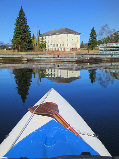
Steamship Katahdin docked in Greenville
And there she was at the head of the pier in Greenville, cheerfully waving and recording my landing with her camera. Since the boat ramp was empty, loading my gear and boat back in/on my little VW Golf was no problem. We picked up a haddock sandwich and coffee for me at the store across the road (grilled cheese and fruit juice for Nancy), and we were off, almost due south, back to Orono.
End of trip
It was another great trip, even better than expected. I cannot remember a better 8-day weather window than on this trip. The sun was out almost every day, the wind was never more than 10 knots, and there was no rain to speak of; only the nights were still quite cold. Moosehead Lake itself was ice-free all the way, even though ice was still clinging to shaded shorelines facing north. Except for a group of fishermen out on the lake near Rockwood and in Spencer Bay on the first day of the 2013 fishing season (May 1), the lake was empty, except for loons, mergansers, Canada geese, a few cormorants and several ravens. The shoreline was a solid evergreen of spruce, pine, hemlock and cedar. The deciduous trees were still bare poles. Yes, there were numerous utilitarian fishing camps, modest weekend get-aways and also elaborate, costly summer homes along certain stretches of the lake. But as yet I could not see any humungous, intrusive development from my boat perch. Things had changed somewhat since my last circumnavigation in 1995, but not very much. Moosehead is still a very large, spectacular body of water, a good distance away from any major city. It takes an effort to get there, but it rewards you with stunning scenery, as well as giving you the feeling of being on a big bay along the Maine Atlantic coast, which appeals to me. And like the Maine Island Trail along the Atlantic, Moosehead Lake also has numerous, well laid out, free back-woods campsites.
Coming into the landing in Greenville, I was all smiles. This was a great trip, a trip I really enjoyed. Thanks, Nancy, for doing the car-shuttle and for being such great company to and from my put-in. I will certainly be back – maybe next time in late fall when the foliage is at its peak, and most tourists and mosquitoes are gone (i.e. everything that might bug me). We'll see. Stay tuned.

Willoughby: "Welcome home, DAD!"
Info/Summary:
100-mile round trip in 8 days, including car shuttles from Orono, Maine (leisurely 12.5 miles per day)
Maps: Moosehead Lake, De Lorme Publishing Co., Freeport, Maine 04032
Maine ice-out dates: www.maine.gov/doc/parks/programs/boating/ice_out.html
Henry Thoreau: The Maine Woods (any edition).
![]()
Click here for a printable version of this article
Reinhard Zollitsch
www.zollitschcanoeadventures.com
************************