A call to action
"It's a long way to Tipperary" - and equally far, so it seems, from Orono, Maine to Bellingham, Washington. You can't travel much further in the US: Maine and Washington State form the top eastern and western corners of the lower 48 states. When kids finally leave home, they rarely think about what it means for grandparents to be asked to "come over to see our newborn", as if we lived just up the street or the next town over.
In late summer, our son Mark and his wife welcomed their third son into this world, "and would we please come visit again for a week to get to know the little cutie". Well, Nancy and I had done it for the other two boys. Fair is fair, and so we booked flights from Boston to Seattle and bus tickets for the remaining stretches.
Fortunately for me, they do not live just anywhere, worst of all in a big city or barren, wide open country with no water around, but on beautiful Bellingham Bay, part of the spectacular island world stretching from Tacoma/Seattle in the south all the way up north to Vancouver, Canada and beyond. I was especially looking at the San Juan Islands, all beautifully protected from the onslaught of the open Pacific by larger outer islands. It is America's original sea kayaking paradise, and I had been eyeing this area for a very long time.

Chart #1 - San Juan Islands (click on map to enlarge image)
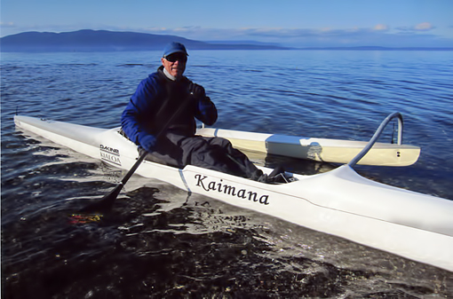
It so happened that my son has a light-weight carbon fiber solo outrigger canoe similar to mine, and now even a super-fast 23-foot trimaran sailboat. What more could I ask for as a trip motivator. My only worry was, how I could get enough grandfatherly visiting in. So this is how my last three visits worked out for me and the family.
Moving in with two wild almost 5 and 7-year-old boys, a dog, 4 back-yard chickens, a new baby and an understandably still somewhat discombobulated mother, not to mention an overworked, overtired dad, did not seem advisable for a happy visit for us and them. So we booked a hotel room close by and agreed to visit and "do things" with the family each afternoon, capped with a family dinner at their home. The mornings, when the boys did their early schooling and dad his work, were ours! No wonder Nancy and I eagerly awaited the dawn of each new day.
Bellingham Bay and the San Juan Islands - the charts
First thing I did was buy charts at the local chandlery, borrowed Mark's old beat-up Toyota Corolla, tied on the 21-foot long outrigger canoe, and off we went for the morning. Nancy again was kind enough to drop me off at certain places and pick me up about 2 hours later, while she found some scenic walks and drives in the area, roamed the local bookstores or just enjoyed some down-time.
But I was mightily surprised when I charted my first course. The variation for Bellingham Bay, i. e. the compass correction, was 20 degrees EAST, not WEST, as in my neck of the woods along the coast of Maine and the Canadian Maritimes. In Maine, one ADDs the 20 degree variation to the intended course. Going 90 degrees east, for example, I would add our western variation and arrive at my compass course of 110 degrees. (Heading south, I would steer 180 + 20 = 200 degrees on the compass.)
Here along the Pacific coast I would have to SUBTRACT the eastern 20 degree variation and would steer 70 degrees in order to go east, or 160 degrees going south. New Englanders who do not pay close attention to the little compass-insert on the chart could be 40 degrees off course, if they only do what they are used to from navigating along Atlantic shores. Not a good picture at all!
It's really no big deal, no reason to get upset: wherever you are, just check the chart and do what it tells you - always! Smile, and don't argue with NOAA.
Chuckanut Bay and the mouth of the Nooksack River

Chart #2 - Bellingham Bay (click map to enlarge image)
One of the prettiest areas of larger Bellingham Bay is Chuckanut Bay, a tad south of the city, south of Marine Park in Fairhaven, from whence the big ferry boat to Alaska leaves. The shore gets increasingly steeper, mostly gray-brown sandstone topped with lush Pacific Northwest rain forest vegetation and significant trees. A few houses manage to find a foothold on the steep cliffs, but Chuckanut Bay looks surprisingly clean and natural. There are a few small islands and a few ledges smack dab in the middle of the bay, to make paddling and bird watching more interesting. All in all, an 8.25-mile loop, or one and a half to two hours for me in my fast outrigger.
Starting out from Fairhaven
When the wind breezed up, mostly from the south or southwest - and that can happen very quickly in these waters - I still managed to fly/surf back to Fairhaven. A more protected option from Marine Park would be to head towards the Bellingham marina and back.
Another trip this year took me from Bellingham to the Nooksack River in the Lummi Indian Reservation. The mouth of the river was silted up way out into the bay from thousands and millions of years of depositing sand and silt from the impressive Mount Baker area. It formed a little delta, my chart indicated, and I thought it might be interesting to go up one arm and come back down another. The two arms I tried, however, were blocked by tree jams, and I had to backtrack, which made this trip my longest, a good 2.5 hours.
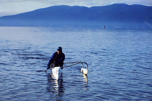
Returning - Lummi Island in background
Beautiful Lake Samish and Lake Whatcom
When the bay was too windy, I circumnavigated two very scenic lakes, Lake Samish and most of big Lake Whatcom. Both lakes are surrounded by ragged mountains, studded with tall and thick-trunked Douglas firs or cedars. The scenery was so different from my New England world of more rounded-off, much older Appalachian mountains, covered with only fair-sized hardwoods, pine or spruce. The younger mountains of the Northwest are much steeper and jagged, and the trees in this rainy neck of the woods much taller than any that I had seen elsewhere.
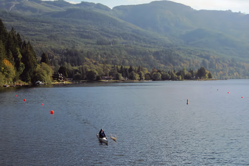
On Lake Samish
I wished I had my Verlen Kruger touring sea canoe along, though, for an extended trip through the myriad of islands from here up to Vancouver or through the San Juan Islands. But you can't have everything.
Flying along at 14 knots
No, not in my solo outrigger canoe. On one day Mark invited me to crew on his 23-foot trimaran Osprey, which he and a friend had designed and built, with lots of carbon fiber composite materials, some from the Boeing airplane factory.
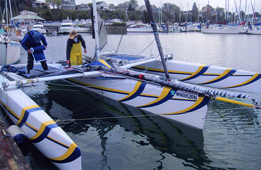
Getting the trimaran race-ready
It was a 20-mile end-of-season distance race from Bellingham south around Jack Island, off Guemes Island in Padilla Bay and back. We led the fleet of a dozen boats most of the way, only to be caught about 3 miles before the finish.
The fleet was bringing up a new breeze from behind and was closing fast; the lead boat even passed us. I made sure we would tack over on their wind. At that point then it was no contest: we howled past them at 14 knots, cold October water flying into our faces, but we were grinning from ear to ear. We beat them by 5 minutes, which was great, but most likely would also change our boat's handicap rating for the next club race, which would make it even harder to win on corrected time. Ah well, we enjoyed the moment - that is what counts in my book.
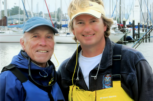
RZ with son Mark
The rest of the visit
Oh, I am sorry, I almost forgot to tell you about the main purpose of our trip. Suffice it to say, the new little baby looked "fine". Ask any grandpa; they all do. (Don't get me wrong; I am extremely grateful for a healthy baby and indeed a proud grandpa.)
The two older boys were as rambunctious as ever, maybe even more so than last year, possibly feeling somewhat unhinged by their parents concentrating on finding their new post-birthing routine, still a bit harried and overtired, but what else is new. Nancy and I were sure it would all work itself out with time, as it did for us, bringing up two boys and two girls.
In the end, we grandparents were happy to "inspect and approve of" the new offspring, while my son and family were proud "to show off their new son and little brother". The two older boys also enjoyed having an appreciative audience for their audacious stunts on their swing set, scooters and bikes, or up in the trees, you name it, after Grandpa was called upon to fix the brakes, handlebars, seats, and a few other loose things. You've got to be a handy-man, being a grandpa! Nancy also was in great demand, either reading to the boys or having them help bake pies for dessert.
So fun was had by all --- and I even had a fast outrigger boat to paddle and an even faster trimaran to sail on, and all this in the most spectacular island world of Bellingham Bay and the San Juan Islands. All in all, not a bad deal, wouldn't you say? --- If only the trip from Orono to Bellingham and back weren't so long.
************************
INFO:
Charts: MAPTECH #104 (The San Juan Islands), # 107 (Bellingham to Skagit Bay).
Boating Guide: R. Carey Gersten & Randel Washburne: Kayaking Puget Sound, The San Juans, and Gulf Islands. The Mountaineers Books, Seattle, 1991/2005.
![]()
Click here for a printable version of this article
© Reinhard Zollitsch
BACK TO TOP OF PAGE